Texas Topography Maps
Successful Texas property design starts before the land is purchased and with Texas Topography Maps. For information about property selection visit my blog post here.
Today, there are thousands of people moving out of the cities. They are migrating across state lines and looking to settle in the country side of the great state of Texas. Whether you are trying to decide on a property purchase or making choices about how to develop a property that’s already been purchased, it is absolutely critical to have a clear picture on the geography of the landscape. Thats when you need Texas Topography Maps. We can help!
Affordable Texas Topography Maps
Fortunately, today we have access to some incredible resources in Texas that make decision making easier. Satellite imagery, computer programs, and LIDAR topography data are powerful tools that allow us to save time and money. Achieve your goals on farms, ranches, homesteads, and conservation properties now! These maps are extremely helpful in selling real estate! However, theres a learning curve involved in processing this data into a usable, affordable and accurate format. I will provide you affordable and quality Texas topography maps in a variety of usable formats. These maps have changed the way I do business and I know will be invaluable to Real Estate Agents, Architects, Farmers, Ranchers, Homesteaders, Conservationists, Small Business Owners, and anyone interested in owning land in Texas.
A Variety of Uses
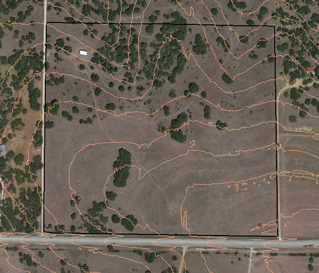
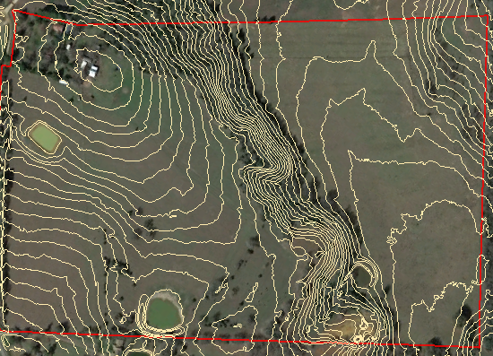
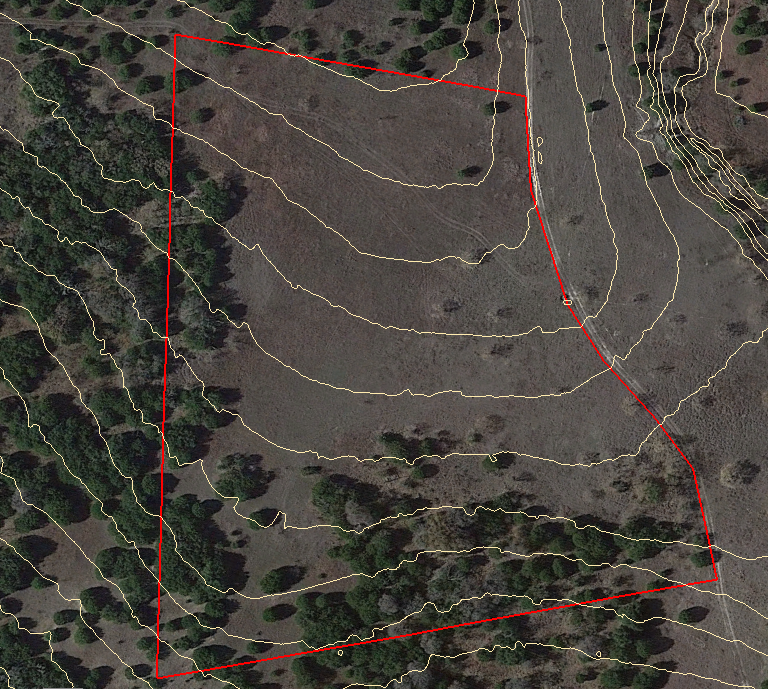
A good topography map, aka contour map, can be helpful in many ways. These maps will help you to determine where the best sites are to build a home, including the orientation of the home in relation to the sun and the landscape. You will be able to identify spots that need to be avoided because of high stormwater runoff or steep terrain when building a driveway. Contour maps will help you understand how water flows through the property and how you will better manage it. Water flows at a 90 degree angle to these level lines that are drawn on the map, because of gravity. My personal favorite is to overlay the topography map onto satellite imagery using a program that’s free to download like Google Earth Pro. This program allows you to zoom in and out, draw lines/shapes, and measure areas on your landscape making it very user friendly!
Here are some formats available: AutoCAD DW, AutoCAD DXF, Microstation DGN, KMZ (KML), Shapefile, CVS, Excel, Vector (AIX/Illustrator, EMF, EPS, PDF, SVG, and SVGZ), Raster (BMP, JPEG, PNG, TIFF, TGA, and GIF)
Process
Currently this service is only for Texas properties. Please email me your name and address, the location of your property, like the property address. It’s very helpful if you can also send an image that shows the boundary of your property and let me know the size of the property (how many acres). Watch this tutorial on the best way to send me your property boundary. We need to make sure that you get the correct map. Let me know what format you would like the data to be sent in. If you are using free Google Earth Pro (recommended) that will be a KMZ file. We’ll send you an invoice via email and once payment is received you will get your topography map in email. We accept cash, check, or payment through Venmo.
Thanks for your business!
No Comments