Blog Large Image Whole Post - Drought Proof TX
18956
paged,wp-singular,page-template,page-template-blog-large-image-whole-post,page-template-blog-large-image-whole-post-php,page,page-id-18956,page-child,parent-pageid-1815,paged-2,page-paged-2,wp-theme-stockholm,ajax_fade,page_not_loaded,,select-theme-ver-3.1,wpb-js-composer js-comp-ver-4.11.2.1,vc_responsive

Texas Prairie History

Texas Prairie History

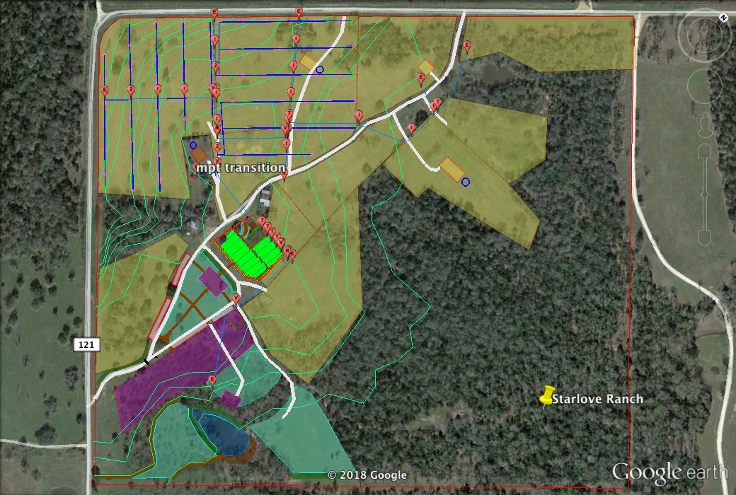
These quotes were assembled by Elenore Goode in order to provide historical context for our work in ecological restoration and regenerative agriculture.

Quotes from the wonderful research on prairies of Del Weniger’s The Explorers’ Texas, The Lands and Waters:

Prairies

“We are led to think of the prairie as flat, treeless and essentially stark and barren. Yet this is not a true picture of a prairie. How has our conception become so twisted?

The problem begins with a confusion of two different words: prairie and plain. Both of these were originally French terms. They exist because – modern dictionaries not withstanding – they mean two different things. The opportunity for confusion of the two is great, for you could have a plain included within and part of a large prairie, but hardly a prairie within and considered part of a plain. 

A plain was a flat expanse which was altogether or practically treeless. It was a plain surface in every sense of that word, and also in the sense of the word plane. The prairie, on the other hand was seldom flat or treeless.

 The essential difference is shown by the most common way of describing a prairie. This was as rolling. No plain could actually roll, since it had to be flat.

The other difference was the vegetation. While both plains and prairies typically had grass-covered expanses, the plains were treeless, while the prairies had trees as an essential part of them. Nothing shows this better than the fact that Dr. Ferdinand Roemer, one of the most scientific observers of early Texas, could write of “the forests of the prairies…”

This unflat combination of grass and trees, a fusion of the forest and the grassland…

“…If the prairie be small, its greatest beauty consists in the vicinity of the surrounding margin of woodland, which resembles the shore of a lake, indented with deep vistas, like bays and inlets, and throwing out long points, like capes and headlands; while occasionally these points approach so close on either hand, that the traveller passes through a narrow avenue, or strait, where the shadows of the woodland fall upon his path, and then again emerges into another prairie. Where the plain is large, the forest outline is seen in the far perspective, like the dim shore when beheld at a distance from the ocean. The eye sometimes roves over the green meadow without discovering a tree, a shrub, or any other object in the immense expanse but the wilderness of grass and flowers, while at another time, the prospect is enlivened by the groves, which are seen interspersed like islands, or the solitary tree, which stands alone in the blooming desert.”

Karl Anton Postl wrote under the pen name of Charles Sealsfield about the prairies west of Houston as they were in 1832: “…we distinguished some dark masses, which we afterward discovered to be groups of trees; but to our eyes they looked exactly like islands in a green sea, and we subsequently learned that they were called islands by the people of the country. It would have been difficult to have given them a more appropriate name or one better describing their appearance..These islands are one of the most enchanting features of Texas scenery. Of infinite variety and beauty of form and unrivalled in the growth and magnitude of the trees that compose them, they are to be found of all shapes – circular, parallelograms, hexagons, octagones – some again twisting and winding like dark-green snakes over the brighter surface of the prairie. In no park or artificially laid-out grounds would it be possible to find anything equalling these natural shrubberies in beauty and symmetry. In the morning and evening especially, when surrounded by a sort of veil of light-greyish mist and with the horizontal beams of the rising or setting sun gleaming through them, they offer pictures which it is impossible to get weary of admiring…I passed several beautiful islands of pecan, plum, and peach [laurel cherry] trees. It is a peculiarity worthy of remark, that these islands are nearly always of one sort of tree…the vine only is common to them all and embraces them all alike with its slender but tenacious branches. I rode through several of these islands. They were perfectly free from bushes and brushwood, and carpeted with the most beautiful verdure possible to behold.”

That these prairie mottes were not figments of early imaginations is clear. That modern poet of nature, Donald Culross Peattie, wrote a whole book, A Prairie Grove, about one of them, and his words of introduction match those of the explorers exactly: “The prairie island and its grove are like the hammock in the everglades, like an atoll in the sea, like an oasis upon the desert….”

This blending of trees and grass which was prairie is made even clearer for us from further descriptions which use another analogy. Dr. Ferdinand Roemer, in 1849, expressed it most simply. Writing about present Harris County, he said, “After passing through the forest, I had my first view of a Texas prairie…The oft-made comparison with an English park on a grand scale appeared very appropriate to me.”

The references here are to parks and orchards, and they are echoed time and again by others. William Carleton, leaving early Victoria in 1855, said, “The country about here was very beautiful indeed, but farther on and until we got to Gonzalez it was beautiful beyond description. I thought I had seen beautiful scenery here before, but what I passed on this route surpassed anything I had ever seen before or imagined. No ornamented ground, no lordly park I have ever seen can be compared with it…”

At about the same time, J. De Cordova was even more specific in drawing the comparison for east Texas. He said, “…But by far the richest and most beautiful district or country I have ever seen, in Texas or elsewhere, is that watered by the Trinity and its tributaries. Occupying east and west a bet of one hundred miles in width, with about equal quantities of prairie and timber, intersected by numerous clear, fresh streams and countless springs, with a gently-undulating surface of prairie and oak-openings, it presents the most charming views, as of a country in the highest state of cultivation, and you are startled at the summit of each swell of the prairie with a prospect of groves, parks and forests, with intervening plains of luxuriant grass…”

Even the southwestern stretches which we do not think of as prairies at all today were described in the same terms. Witness Cora Montgomery’s description of Maverick County in 1852. She put it this way: “Our embryo town [Eagle Pass] lies on a sloping prairie, sprinkled with mesquite trees like a vast and venerable orchard, and falling in successive platforms or terraces down to the river’s edge.”

This, then, was the original Texas prairie. Imagine, those of you who know the lakes and bays and oceans, who have seen capes and headlands and islands, these scenes transposed into similar configurations, with slopes and hillocks and hollows of grass and flowers, and skirts and groves of trees in place of shores, points and islands.

Time and again the explorers expressed feelings of relaxation and relief in moving out of either forest or large plains into prairies.


The Quantity of Trees in the Original Prairies

But on to some details of the prairies. First, what was the relative amount of trees and grass in a prairie? No simple answer to this question arises out of the early accounts. It appears that this is because the proportions were so variable.

There were prairies described which had so many trees that the explorers threaded through the narrow straits between the forests, and the openings were those beautiful little, locked-in meadows we have already described. Other prairies had the trees as only scattered islands…Then there were prairies with their trees few and standing singly…There were even prairies with large flat, treeless spaces – the plains within the prairies – between fingers of forests.

Olmstead stated that the proportions of grass increased and trees decreased from east to west across prairies. This is as it should be if the prairie is actually the zone of juncture of the eastern forests and the western grassland – or the strip between them which neither can totally claim.

There is general agreement that the prairies of east Texas were about equal part wood and grassland. Kennedy stated this for the whole country watered by the Trinity and Brazos, the upper San Bernard, the San Andres and Cummins Creek. We have seen that De Cordova corroborated this about the land in the Trinity River watershed as did Mirabeau B. Lamar…

In central and south Texas were many prairies. Kennedy calls them “A vast chain of prairie, extending from the western bank of the Colorado to the mountains…” This word – chain – is very well chosen, for in this region one apparently found the prairies strung out in a row from east to to west. Abbe Domenech says of this area, “the prairies are divided by forests which extend along the rivers.” But here these forests were not wide. Kennedy says, for instance, that “The Colorado bottoms differ much from those of the Brazos and the rivers of Eastern Texas, which are always covered with a heavy growth of timber. Many of the richest bottoms of the Colorado are prairie of extraordinary fertility…” Olmsted concurs, saying, “We struck the Colorado at Bastrop…The bottom was here narrow, the surface rising rapidly to open prairie or post-oak… The scenery along the river is agreeable, with a pleasant alteration of gently-sloping prairies and wooded creek bottoms.”


The Grass of the Prairies

Another crucial question about prairies arises – how much grass was in their meadows, and what was it like?

Kennedy’s observer, Hall, is most specific of any about this. He tells us, “In the summer the prairie is covered with long coarse grass, which soon assumes a golden hue, and waves in the wind like a ripe harvest.” The point is that rather than a close-cropped, velvety sward, the prairie grass was a tall and stalky crop. By the middle of summer it had turned the gold of ripeness. The scene was, for most of the year, that of a standing or later and unharvested, falling grain field, with the breezes rippling the tall stalks like it does the ripened wheat on much of the same ground today.

But if this is so, how could the pioneers call these fields lawns? We moderns are once again tricked by the narrow image a word may give to us of so little experience. Only for those of the last fifty years or so since the development of mechanical mowers had a lawn been merely inches high.

Just how tall was this harvest? Hall is specific here also. He continues:”…In the low, wet prairies…the centre or main stem of this grass, which bears the seed, acquires great thickness, and shoots up to the height of eight or nine feet, throwing out a few long, coarse leaves or blades, and the traveller often finds it higher than his head, as he rides through it on horseback.“

If we are ever to imagine the low prairies of east Texas west to Dallas and the Blackland Belt, we must force ourselves to see these grass forests with the heads of their grasses often nodding as high as our own. The degree of difficulty we find in imagining this scene as we stand outside any of our Prairie Views or Grand Prairies today, with the grass hardly to our boot-tops, measures how far removed we are from Texas as it was.

And so it was in the mixed-grass prairies, with the grammas, the dropseeds, lovegrasses, etc. topping out at three to five feet tall. They will still do it wherever they are left uncropped and the soil is yet undepleted.

It was only the prairies of northwestern texas which originally had the short grass standing only a foot or so high. These were usually called by the explorers mesquite prairies, after the mesquite trees whose presence helped make them prairies instead of plains and after the excellent grass which grew associated with these trees.

North Texas prairies had grass tall enough to hide all but the antlers, necks and tails of bounding deer or the humps of grazing buffalo, while south texas prairie grass was tall enough and thick enough to hide men crouching on sleds being pulled through it by oxen. What luxuriant cover this was! What a commentary on our greed is the naked, almost barren state of our overgrazed prairie pastures today, which will hardly hide a rabbit.

Perhaps someone objects. Someone who appreciates flowers may think of all this grass as monotonous and insist that the blanket of flowers on our modern, almost grassless prairies is preferable. I must hasten to state that there were plenty of flowers in those grassy prairies – probably even more than today. Frederic Gaillardet, in 1839, stated that, “For nine months of the year Texas is a green carpet decorated with wild flowers.”

Hall’s observations brought to us by Kennedy detail the scenes through the whole growing season: “The first coat of grass is mingled with small flowers, the violet, the bloom of the strawberry, and others of the most minute and delicate texture. As the grass increases in size, these disappear, and others, taller, and more gaudy, display their brilliant colours upon the green surface; and still later, a larger and coarser succession rises with the rising tide of verdure.

The whole of the surface of these beautiful plains is clad, throughout the season of verdure, with every imaginable variety of color, from grave to gay. It is impossible to conceive of greater diversity, or a richer profusion of hues, or to detect any predominating tint, except the green, which forms the beautiful ground, and relieves the exquisite brilliancy of all the others.

The only changes of colour observed at the different seasons arise from the circumstance that, in the spring, the flowers are small, and the colours delicate, as the heat becomes more ardent, a hardier race appears, the flowers attain a greater size, and the hue deepens; and still later, a succession of coarser plants rise above the tall grass, throwing out larger and gaudier flowers. As the season advances from spring to midsummer, the individual flower becomes less beautiful, when closely inspected, but the landscape is far more variegated, rich and glowing.”

Sealsfield (Postl) confirmed this description of northern prairies as applying also to Texas by writing of a scene he witnessed in 1832, in western Harris or Waller County: “…the part of the prairie in which I now find myself presented the appearance of a perfect flower garden with scarcely a square foot of green to be seen. The most variegated carpet of flowers I ever beheld lay unrolled before me – red, yellow, violet, blue, every color, every tint was there – millions of the most magnificent prairie roses, tube-roses, dahlias, and fifty other kinds of flowers. The finest artificial garden in the world would sink into insignificance when compared with this parterre of nature’s own planting. My horse could scarcely make his way through the wilderness of flowers, and I for a time remained lost in admiration of this scene of extraordinary beauty. The prairie in the distance looked as if clothed with rainbows that waved to and fro over its surface.”

So there were enough forbs to sprinkle all this grass with flowers all the growing season. The ones we know had their season, and perhaps some of them grew in that rich mulch far taller than we see them today, while even taller ones may have disappeared along with the tallest aristocrats of the grasses.

There were, in Texas, some special kinds of prairies. These seem to indicate special environmental situations prompting special biological communities, or else prairies with unusual topographic features.


Weed Prairies

One of the most interesting of these was the “wee prairie.” The name does not indicate any tiny size of these prairies, but is a curious corruption of the term, “weed prairie.” These were apparently localized situations where little grass grew and forbes ruled exclusively. They were described in 1839, by Kennedy, as follows: “In their ‘wee prairies’, the counties of Robertson and Milam possess a characteristic of the soil peculiar to themselves. These prairies, unlike most of those in other localities, are covered with a thick growth of weeds instead of grass. These weeds are generally from ten to fifteen feet high, and so dense that they are almost impenetrable to man or horse, resembling in some respects, the cane-brakes of the alluvial region. The settlers highly estimate the productive power of the weed prairie.” De Cordova is the only other early writer to mention these, speaking of the “…immense bodies of fine weed-prairies, so proverbial for their fertility,” in present Falls County. As far as we know, these peculiar prairies were limited to the three counties named in these passages.


Shaking Prairies

A strange passage exists which can do little more than intrigue us. It consists of two sentences written by the Abbe Domenech about a situation encountered when travelling in what is now Cameron County at the southern tip of Texas. The Abbe relates: “We then passed over glades and prairies where the earth was so light and soft that sometimes it gave way under our horses’ feet. The rancheros call these tierras falsas (treacherous grounds): after rain they are very dangerous; man and horse sometimes sink and disappear in them, as in shaking prairies.” Was this soil so fine and sandy that it could form a quicksand-like mass after rains, or were there at that time old resacas so choked with partly decayed plant material that horse and rider could sink into them? Who knows today? At any rate, there must have been something unsteady enough that we can add the term, shaking prairie, to the list of strange Texas locales.


The Wetness of the Undrained Prairies

The result of all of our modern activity has been to improve the drainage of wetlands. Our agriculture and our desire for convenience cannot tolerate water standing anywhere except behind our dams or in rice fields, and so we forget what the country was like before drainage projects. We therefore don’t realize what the low-lying prairies, on many of which we now have nice, dry cities, highways and farms, were originally like in the wet season.

Dr. Roemers account of the traveller’s tribulations in 1849 on a wet prairie should enlighten us: “Hardly had we left the city [Houston] when the flat houston prairie loomed up as an endless swamp. Large puddles of water followed one another and at several places a large section of land was under water. All of the low coastal region presents a similar picture during this time of the year…darkness fell and still we had not reached the end of the prairie, nor did we find a dry place to lie down…[in the morning] we proceeded on our journey. We were confronted with the same obstacles met with on the previous day. An extensive, level prairie, now and then broken by a sparse grove of oaks, partially covered with water, lay before us…Night overtook us in a wet, open prairie, where not a stick of wood could be found to kindle a fire.”

These were the prairies of Texas. They made up a larger part of the State than any other natural community. There was much variation in them, as they were themselves a curious blending of hills and plains, forests and grassland, forbes and grasses.


The Early Destruction of the Prairies

By late in the 1850s these prairies were vastly altered – so much so that by the end of that decade descriptions were not of the prairies in their original state anymore. By 1860 many of the trees on them were cut and much of the grass had disappeared. Although actual cultivation was ripping into them by then, two other forces accomplished the first destruction of the prairies even before the plow.”

One of the first agents in the destruction of the prairie was the so-called domestic animal. It was the practice of the pioneers to turn as many cows, sheep and goats as they could acquire loose in the prairies and reap the gain in offsprings of the prolific, semi-wild herds. In south Texas the missions pioneered by introducing the Spanish open ranching system full-blown, and the hers were prodigious. By the 1760s the five mission ranches in the San Antonio area were working a total of more than 5,000 cattle and 17,000 sheep and goats, while the mission Espiritu Santo, near present Goliad, had a total of 16,000 cattle by 1768. In north and east Texas the other settlers needed no old-world systems. They managed in their own ways to get the cattle and sheep and goats out onto the prairies and re-capture a part of the increase.

One can imagine the destruction worked upon the prairie vegetation by such herds. There was a respite as the mission activity dwindled and failed by the end of the eighteenth century, but soon after that the settlers flooded in, each establishing his herd and turning it onto the prairies. Add to these the myriads of wild horses grazing everywhere by then, and one must envision the tall grasses being whittled down year by year. The tall, standing biomass, the life of the prairie as surely as the trees are the life of the forest, was being eaten away. By the 1850s this process was far enough along that the prairie was often stripped, naked and dying, and it sometimes took some of its tormentors with it.

Olmsted describes a scene of such an early death of some prairies. When he was travelling down the Guadelupe River, he said, “On the 20th February [1854] we reached Gonzales. The prairies through which the road passes were cropped very close, and we passed many carcasses of cattle that had miserably perished by the road of cold and starvation.”

There was another destruction being wreaked upon the prairie by this time.

Carl, Prince of Solm-Braunfels described it in 1854 – and notice that he recounts the practice as a happy one, making the farmer’s life easier. “Throughout the entire winter the prairie sare covered with green grass. When it becomes dry, it is burned, after which the prairie looks black, producing a rather dreary effect. Only one food shower is necessary to erase the black appearance and to enable the fresh grass to shoot up and cover the plain with its refreshing greenery.”

The extent of this burning of the prairies must have been great. Olmstead, in his 1854 travels, while in present Leon County, said, ‘Most of the prairies have been burned over. Both yesterday and today we have been surrounded by the glare of fires at night.”

Already in 1849, Dr. Roemer said, “The grass had been burnt nearly all the way from San Felipe to this point [on the San Bernard River] The monotonous black ground extended as far as the eye could see. A few deer which were cropping the tender stubble were the only living things we saw. AT another place several prairie chickens (Tetrao cupido L.) fluttered out of a strip of long yellow grass which had not been burned, owing to the moist soil found there.”

And in 1846, McClintock, while traveling through what is today western Limestone and eastern Falls Counties, said:  “Scarce any timber today, a few scattering musquit trees, many quite dead, others dieing. The gray and bleaching trunks and boughs present a melencholly appearance…The Timber is of slow growth, and easily killed – great quantities are destroyed by the burning of the prairies.” 

This fire was a new enemy of the prairie. McClintock’s mesquites were just dying from it in 1846. There is no evidence that the prairie fire started by lightning was ever any more than a freak happening of local consequence. Nor, contrary to many statements, is there any evidence that the Texas Indians ever used fire to drive out game until they learned the practice from the Spanish. But they learned that technique quickly, and the ranchers burned after them in their turn. Thus the prairies capital was repeatedly reduced to ashes. Herds of cattle and sheep and goats were always ready to chop off the new growth when it came back, and the prairies could not rejuvenate themselves. So by 1860 the grand prairies existed only in pitiful remnants, and we leave them here.

The prairies of Texas were as grand as the sea, with moods and vistas as variable, but with a grace and tidiness which would do justice to a civilized park. They were as fruitful as an old-fashioned orchard field. They waited here, a home away from home for the wanderers, some of the most hospitable scenes for any settlers to enter. And they could have supported many humans while surviving as prairies. But we destroyed them in our greed. Where would you go to see a real prairie today?”

0
4

Starlove Ranch Design

Design

Starlove Ranch is a 100 acre property near Giddings, Texas that is currently being continuously grazed by cattle for a small beef production operation. The ranch is transitioning from animal production to plant based production. They are working in partnership with the organization Farm Transformers that promotes and supports vegan farm transitions and farm animal sanctuaries. The 26 cattle will stay on the land safe from the sale barn and be managed to help kickstart the plant based production. Starlove Ranch is also aspiring to build a beautiful camp out wedding venue on the land. I will now take you through each layer of the design (excluding climate) which was created using the Regrarians Platform and Google Earth Pro.


Geography


The image below shows the property boundary and a roughly accurate topography map for most of the property at 2 ft intervals. It was difficult to get good information of the topography in the forested areas. However, I was able to get enough information to make design decisions and verify them in the field.  The land is beautiful with low rolling hills and thick forested areas. The soil on the surface is a sandy clay loam but the clay layer beneath is heavy and impermeable. There are post oaks, live oaks, yaupon holly, eastern red cedar, mesquite, huisache and cedar elms growing on the property.
 
 
Water
 
Starlove will begin managing the cattle a bit differently, switching from continuous grazing to managed rotational grazing. To protect the land from overgrazing and ponds from erosion the animals will be moved around the property using electric fencing. This can be done effectively but more water availability will be needed around the property. The light blue lines in the image below are underground water pipes that carry water around the property so that cattle can be paddocked away from the ponds and still have water availability. Having clean water on demand with a float valve will also keep the cattle healthier than allowing them to drink and defecate in the same water at a pond. We will also use this system to irrigate trees,shrubs and the garden. Water pipes will also provide water redundancy to the house sites which should also have rain tanks. We will be fusion welding polyethylene pipes from 3/4″ -2″ in diameter, no pvc. All fittings will be underground in irrigation boxes safe from frost. The pond is also marked in blue with the dam wall in brown. There are also brown lines that mark berms and swales to be built to increase the ponds catchment area by 50 %.
 

This next photo shows all the fittings like valves, tees, inline assemblies, reducers, transitions, and 1/2 poly pipes for surface irrigating trees and shrubs. Each pin has a parts list and description designated with it.


Access

This next image shows the access system around the property.  I added a road loop and also another road into the huisache thicket. The roads going into the pastures do not have to have road base, they are just more like farm tracks. The entry road will be build up to two lanes to accommodate wedding venue traffic. The brown lines show foot paths around the reception area and camping sites. The grey rectangles are parking areas. The parking is right off the road and requires much less grading work, equipment rental and materials moving than building a single parking lot. Big money saver here. This parking design yields 70 parking spots. There are also two culverts that need to be installed to maintain positive drainage around the driveway. I try to keep the roads on ridges or near contour for ease of maintenance and longevity.


Forestry

The dark green shaded areas show where various kinds of trees will be planted. Because it is a wedding venue I would like to plant some native trees that are beautiful and nostalgic like pine, oak, sycamore, cottonwood and cypress. These are along the pond, the entry way of the property, around the reception area, etc… The green and pink circles mark tree cages that will protect the nut orchard from cattle, deer and hogs. Every other tree in this orchard is a pecan the rest are a variety fruit trees, forage trees, pollinator trees. Each tree cage will also protect 3 blackberries. This is like a zone 4 area of mixed forestry. This layout is around 130 trees and nearly 400 blackberries in the back fields. They have 110 ft alleys between the lines and the trees are at 50 ft spacing in the lines. The tree cages will be 8ft squares made from cattle panel and T posts. Each cage will have irrigation set up on a battery operated timer. The rest of the trees will need much less protection since the cattle will be excluded from those areas.
 
 
The following image is a close up of the orchard. The orchard is laid out in straight lines for ease of cattle management with electric fencing. However, the straight lines also adhere closely to key line patterning for soil and water conservation. This pattern mostly moves water towards the ridge in the pasture. The ground will be prepped with a keyline plow before the trees are planted, each line of trees will get 6 rips. We will not be key line plowing the grazing alleys. The blackberries will provide a bounty of reliable fruit for the family and their farming operation while the pecans will provide long term profits and benefits of a beautiful food forest.
 
 
Buildings
 
There are various building plans for this property including a cabin, two homes, and a shipping container storage facility. The buildings are marked with orange shaded rectangles, the homes are all accompanied with rain tanks indicated with blue circles. The family is also very motivated to have their homes built to harvest solar energy on the roofs. This will be a great option as grid electrical would require criss crossing the of electrical lines and poles across the property.
 
 
Fencing
 
This property already has perimeter fencing and many functioning interior fences that we will be working off of. The cattle fencing will be adjustable and movable so it is not indicated in this next image. The only new fencing needed is a 6ft fence around the new garden site. The fencing will be built with 10ft 6×6 posts that are 42 inches in the ground, 2×4 wire fencing and a total of 5 gates.


Soil
 
The yellow areas are grazing areas. I suggest moving the cows with electric fencing. The brown lines around the yellow are suggested paddocks cows can be moved to. Managing like this allows other pastures to recover from grazing and grow better forage. They will still have to feed the cows, monitor their body condition and monitor their manure. The cattle are unadapted herefords that need selective grazing to maintain body condition, but the land needs to be rested from grazing as much as possible, so paddocks sizes will be moderate and moves will be carefully managed while also provided supplemental feed. The turquoise shaded areas are wildflower prairies and will have to be managed by occasional mowing or grazing. These painted prairies will be beautiful in the spring and show off the natural Texas beauty of this land. The pink area next to the barn I am proposing to become a 1 acre garden where the family can grow plenty of veggies, herbs, and fruits. They will be able to plant 50 fruit trees here in this garden and many productive perennial shrubs. This garden will be right next to the reception area where interested guests can walk through and experience the beautiful poly-culture garden!
 
 
The following image shows a close up of the garden. The light green lines show the way planting will be patterned. These areas are 30 ft wide and will be managed as a no till system and rotated from high productive crops to lower value cover crops each year. The dark green lines are rows of fruit trees and productive shrubs. The gardens will have rotor sprinkler heads down the center of each annual alley. There is a 10 ft headlands between all planted areas and the fence. We will prep the ground by deep ripping with the key line plow, the use a tiller to disturb the grass and weeds that are currently growing. We’ll top off this off with a layer of minerals, seed, compost and mulch. The ground will not be tilled again and we plan to have plants growing year round as much as possible. The green shaded rectangle represents the nursery and mushroom growing area in the shade of the live oak trees. The red shaded square is a materials staging site within the garden. There is also pollinator garden areas indicated in light blue.
 
 
Economy
 
Aside from growing fruit and vegetables Starlove Ranch will also be host guests as a camp out wedding venue. The Ceremony area is shown as the purple rectangle near by the pond. This area will be private, cozy, and overlooking the remodeled pond. The ceremony pad will be 75’x50′. The reception area is the purple rectangle near the garden, 110’x70′. Guests will gather here after the ceremonies. The remaining purple areas show where camp sites will be developed.


Energy
 
Starlove Ranch will be installing a grid tie solar system on their new well house to power the farms reticulation system with the sun. The future homes are also being planned to include solar with battery powered systems. Hopefully in the near future this system will be much more optimized and affordable. The orange line indicates where existing grid power lines are in place up to the meter. By using solar we will limit the amount of power poles and power lines crossing long distances over the property.
 
 
I am looking forward to getting started on this unique and challenging project.
0
4

Keyline Garden Design

Today I am sharing my new Keyline garden at Texastopia Farm. This is where we will grow medicinal herbs like chamomile, lemon balm, echinacea, comfrey, yarrow and many others. This garden is special because it was built on a very degraded caliche hillside. I believe this garden will soon demonstrate that it is possible to grow high quality food and medicine while restoring degraded landscapes at the same time.

First Garden at Texastopia

This new garden is an addition and retrofit to an existing garden that was built by the previous owners of the property. In that original garden I built some raised beds that were all very nearly on contour. The beds were made with finely shredded mulch, algae harvested from the Blanco river and compost. I ran drip lines down each bed for irrigation. During the first year this garden was slow to perform, the wind would easily dry the beds out and the plants were slow to grow. As the months have gone by all of that organic material has begun to decompose. The fire ants and earthworms have been turning the soil from underneath into the mulch and compost. The result has been the creation of some fantastic garden soil, plants began to grow vigorously towards the end of this last summer. We had a great harvests of milky oats, tomatoes, holy basil and our spring wildflower blooms lasted into December. The diversity of the garden was the main attraction for cardinals, hummingbirds, bees and butterflies.

Brand new beds just watered in. We built the beds right on top of the Bermuda grass with no weed fabric, plastic, or cardboard underneath.


Here are the mulch beds with a fresh coat of mulch. These beds easily dried out at first from sun and wind, but now are holding water much better.


Close up of one bed in the first growing season. The diversity of plant roots provides many different types of feed for microorganisms. The beds are now completely shaded and many different types of fungi can be seen fruiting and mycelium has spread throughout the beds completely. The fungi are the teeth breaking down and eating the wood mulch inside the beds, turning it into luscious soil that has a clean forest smell.


This is picture was taken in late spring of the gardens first year. There are garden beds down there underneath the plants. Sunflowers did a great job giving us summer shade in the garden and bloomed spectacularly for the many pollinating visitors.


Garden Expansion

After the first year I decided to expand the garden. This expansion offered a great opportunity to practice some Keyline patterning with garden beds. Special thanks to Kirby Fry for being a great mentor, without him I would never have been able to build a garden like this. Together we have grown comfortable designing and installing systems similar to this.

This is what the area looked like before we started the garden addition. Almost 100% bare soil. The only things growing were sticker burrs and KR bluestem. Will things actually grow here?


The first thing to do was survey and lay out the garden and fence with flags. After laying out the keyline pattern, I began to move soil into the garden area to build the beds. I used some fill dirt as the base for the beds, which is mostly gravel and caliche. This is not the best substrate, but its what we had available on the farm. Once the base for each bed was built I began working on the fence.


The fence is 6 ft tall with 6×6 corner posts, 2×4 welded wire fencing and I used T-posts as the line posts.


This is a picture of the finished 6 foot fence. Thankfully my good friend Kirby Fry was willing to come over and help me get all this wire-fencing put up.


Here is an overhead view of the first garden and the new garden under construction.


Once the fence was complete it was time to start top-dressing the new beds with compost, mulch, and seed. We used compost from Geo-growers in Dripping Springs, oat straw from a local farmer and a diverse variety of annuals, native and cover crop seeds.

Here the beds are seen top-dressed with Geogrowers dairy compost.


Heres I am spreading compost and getting ready to rake the beds to perfection. The garden paths are already mulched.


This keyline garden is patterned for soil and water conservation. All of the bare soil is now covered with a layer of organic matter and seed. This garden is now a huge sponge capable of soaking in heavy rainfall.


Keyline patterned garden beds with fresh mulch. The beds are parallel to each other and designed around a single line on contour.


The final step to complete this garden was to add irrigation. I ran a 1 inch poly pipe up to the center of the garden and now can run all 4 sections of the irrigation system at the same time. This time I opted to use 360 degree micro sprayers on the garden beds instead of drip line. This gives us better seed germination and waters the beds more thoroughly.


Here is a photo of the irrigation system running and our new seedlings coming up!


The finished product is a drought proof garden that harvests rainfall and mitigates runoff in an area that was once completely degraded. In spring this once source of albedo will be vibrant with wildflowers, herbs and buzzing with bees and hummingbirds.

This photo of our keyline garden was taken the first spring April 10, 2018

For anyone interested in building these types of regenerative systems please inquire about our upcoming educational course that will be led by local legend and design mastermind Kirby Fry and myself in the spring!

0
3

History

History


Hill Country Flood in September 1952


The following information about the September flood of 1952 highlights intrinsic characteristics of drought and flooding in the Hill Country. Large amounts of precipitation fall in a very short time. Most of this rainfall is shunted off the land before plants, animals or people can effectively use it. It is important to retain as much of this moisture high up in the landscape as possible to prevent damage from flooding and drought.


Drought


This particular flood happened during a time of extreme drought. According to the records of the Lower Colorado River Authority, Lake Travis’s all time low is 619.06 feet, recorded on September 6, 1952. The Llano River at Llano had virtually dried up in August, requiring the city of Llano to ship in water on train cars. The federal government had sponsored a program called “Operation Haylift” to ship hay from Iowa to Texas and there were very little crops being grown in Texas. Many Hill Country streams were at their all time record lows. Texas in the early 1950s was a very dry place in need of a reprieve.


Rainfall


In September the Hill Country received torrential rainfalls exceeding 20 inches in 48 hours. On September 9 gentle showers settled the dust with 1-3 inches of rain over various counties. Then the gentle showers turned into the heavy deluges that this area is known for, ranging from 3-8 inches across the Hill Country. On September 11 Blanco received 17.5 inches, Hye 20.7 inches, Llano 12.5 inches.


The Blanco River at Wimberley had only 11 cfs flowing on September 10 at 4 A.M. At 8:30 am on September 11 the river had rose to 30.10 feet and attained a peak flow of 95,000 cfs. In San Marcos, the floodwaters from the Blanco caused the San Marcos River to flow backward. The backflow of the San Marcos River over topped the highway 81 bridge. Once this extreme amount of runoff enters the river it is lost and cannot do its job to mitigate drought conditions. It may sound unrealistic, but much of this runoff could have been mitigated with just a few percentage increases in soil organic matter. For example raising the soil organic matter by 1% on one acre allows the soil to hold an extra 25,000 gallons of water. Raising it 1% on a 1000 acres yields 25,000,000 gallons of water storage in the soil, or around 75 acre feet of water volume stored in the soil via soil organic matter. We can also preserve our current water storage capacity in the soil by protecting the soil from erosion.


The Pedernales River received the most intense runoff of this event; 15 inches of rain fell in Fredericksburg, 26 inches down poured in Stonewall and Hye. The Pedernales at Johnson City had no flow on September 9th and on September 11 achieved a new record flow rate of 441,000 cfs and a new peak height of 40.8 feet. The USGS noted that cypress trees 5 feet in diameter “were broken off like matchsticks” and pecans 2ft in diameter were uprooted and washed away. This is reminiscent of the 2015 Memorial Day flood on the Blanco River in Wimberley where the cathedral of cypresses was lost and the landscape changed dramatically. The flood scraped the river bottom down to bare rock. The bridge on Highway 281 over the Pedernales had lost large sections and beams. Lake Travis gained 701,000 acre-feet in a single day, nearly tripling its volume in 24 hours. The level of Lake Travis gained 57 feet and filled the lake for the first time in seven years. Lake Travis did a great job of harvesting this floodwater and at the same time has been able to provide water to people during times of drought. However, the risks involved with this amount of water storage far exceed the benefit and only treats the symptom of the floods. In order to mitigate to high financial cost of flooding and the further degradation of our riparian areas water should be encouraged to infiltrate into the soil with all appropriate means as high up in the landscape as possible. This helps dissipate the high energy of the water in riparian areas.


No Drought Relief


Despite the intense rainfall, drought conditions persisted in the Hill Country and all of Texas. There was little to no rain reported for the entire month of October. This highlights the cycle of drought and flood in central Texas. Water storage capacity in the soil can be improved with polycultural forestry, intensively managed grazing systems, appropriate earthworks or a combination of all. Harvesting water high in the landscape via infiltration turns the problem of intense rainfall and flash flooding into a profitable and sustainable solution. Extreme flood events like this should be stored to mitigate drought, storing it in the soil is the cheapest and most effective way to do so. Instead the flood of 1952 caused damage to the soil that further degraded out water storage capacity in the soil. One Farmer in the Hye area had as “Fine a field as to be found in Gillespie Country before the rain. Now the field is just gravel and clay since all the topsoil was washed away.” This farmer’s field like many, is now less drought resistant than before because of the loss of topsoil which is rich in organic matter that holds tons of soil moisture, 113 tons of water per acre for every 1% organic matter. Subsoil’s that are exposed to the elements also erode more quickly and allow less infiltration resulting in increased runoff which exacerbates flooding. Optimizing lands ability to harvest water requires 100% ground cover 100% of the time. Damaging floods will be ended by ending bare soil.


Pete Van Dyck


Sources

“Flash Floods in Texas” Jonathan Burnett 2008


“Chapter 1 The Climate” Regrarians eHandbook 2015


https://www.nrcs.usda.gov/Internet/FSE_DOCUMENTS/stelprdb1082147.pdf


Photo:http://www.theatlantic.com/national/archive/2015/05/wimberley-texas-flood/394307/

0
3

Climate and Geography

Flood Proofing the Texas Hill Country

Climate and Geography

Flooding in the Texas hill country is largely a result of the locations unique climate and geography. In the fall of 2016 Leslie Lee wrote for the Texas Water Resource Institute:

“Major flash floods are common along the Balcones Escarpment because of two factors prevalent in the region, according to experts: intense rainfall events and efficient drainage off the landscape.

“The region has some of the highest flood discharge per unit area of a drainage basin in the country,” said Dr. Richard Earl, professor in Texas State University’s Department of Geography. Earl, who joined the department in 1991, has studied flooding hazards for decades and has experienced numerous floods in San Marcos.

High rainfall intensities are common in the region because there’s an infinite source of moist air from the Gulf of Mexico, he said.

Over Texas, these moist, warm air masses from the Gulf collide with cool air masses from the north and moisture flow from the Pacific, said Dr. Nelun Fernando, hydrologist at the Texas Water Development Board (TWDB). When warm and cool air masses combine, it results in instability as the warm air rises above the cool air. Additionally, the Balcones Escarpment’s hilly terrain acts as a “ramp” for the fronts and “enhances what was already taking place between the two air masses,” she said.

“The rising air condenses and that creates rainfall,” Fernando said. “That effect gets concentrated over the Balcones Escarpment, and if very slow-moving frontal systems come through, such as what happened with the 2015 Memorial Day storms, then this constant stream of moisture from the Gulf will produce many inches of rainfall over a short period.”

This is called an orographic effect, where a change in elevation causes moisture-laden winds to deflect upwards and cool, resulting in rainfall, said Dr. Robert Mace, TWDB deputy executive administrator for water science and conservation.

“The transition between the Gulf Coastal Plain and the Hill Country is recognized nationally as a place where topographic changes cause these intense, localized floods,” he said.

Combined with its propensity for intense rainfall, the region’s rocky topography makes it flood-prone.

“The Hill Country is karst terrain, so it’s limestone that tends to erode in beautiful ways, but along with that beauty you get thin soils, hard surfaces and steep hills, and that all serves to funnel rainfall very quickly into restricted valleys,” Mace said.

Such terrain is created by the Balcones Fault zone, expressed on the surface by the Balcones Escarpment, which “goes through the heart of Texas,” Mace said. Along the escarpment and in areas just north and west of it, almost the entire landscape is sloped.

“It is fluvially dissected, which means that when it rains, the water doesn’t sit there — it runs off into the streams,” Earl said. “That’s hydrologically efficient drainage. When it rains, it just rushes into the streams and you get really intense increases in the amount of flow in the stream.”

Clay-rich soil types in the region are another contributing factor because once they are wet, clay soils have low infiltration and high runoff.

“And, much of the rural landscape is overgrazed,” Earl said. “Combine that with the fact that there’s increased impervious cover around cities and suburban areas — all of these things work together, almost in perfect combination to result in extreme floods.””

While this article states that there is an infinite supply of warm and moist air from the Gulf of Mexico there are also times of drought in the hill country. Often intense rainfall delivers much of the years rain all at one time. Although the geography is efficiently draining like Dr. Earl said, the karst limestone and high calcium soils also have a high rate of percolation. Karst limestone is much like a sponge, full of fissures and a honeycomb of holes that create underground rivers, water cannot pool on the surface for long because of the permeability of the bedrock. The high calcium soils in the hills have the ability to infiltrate water very rapidly because the clay particles in high calcium clays stand apart electrochemically. This is why ponds built in caliche do not hold water unless there is an existing high water table. These conditions give the opportunity for heavy rainfall to be pacified and infiltrated if the water can be slowed, spread, and sunk into the soil. The geography and soil conditions of the uplands in the hill country can be used to harvest flash flood precipitation and used to recharge shallow groundwater and aquifers turning the problem into the solution. By using the limestone hills as water storage tanks it is possible to harvest enough water to keep the aquifers full and rivers running year round while also limiting damage from flooding. Many flood events produce enough precipitation to supply all the water that central Texas needs, it needs only to be harvested and stored high in the hills as long as possible.

Reducing runoff starting from the hilltops protects the already eroded and thin layer of topsoil and allows nature to use water for topsoil regeneration via organic matter production. According to the NRCS every 1% of organic matter in the first six inches of topsoil holds 27,000 gallons per acre. Protecting and regenerating our topsoil is key to preventing flash floods in the Texas hill country.

Climate of the Mind

It is also important to consider the climate of the human mind that occupies this region. Flooding in the hill country can be better understood by analyzing the way decisions about land management are made by the population, in general.

Hilltop Development in Lakeway, TX

The natural beauty of this region increasingly attracts more residents and development. Hilltops and plateaus are cleared and used as building sites, which not only creates impervious cover at the top of the watershed but also reduces the hilltops ability to absorb precipitation. The result is a lowered water table beneath the hills, and is exasperated by well pumping as population continues to grow. This increase in runoff gains incredible amounts of energy as it moves down the steep slopes. This high-energy runoff is then channelized in waterways, destroys riparian zones and the real estate adjacent. Overdeveloped waterways in the hill country no longer have stable riparian ecosystems that can buffer the damaging floodwaters because they have been replaced with homes, roads and amenities. Developments are designed and engineered around drainage, but can be balanced with designed infiltration and runoff mitigation.

Development on the Guadalupe River in Kerville, Tx

Rural landowners in the hill country have tremendous ability to harvest water and regenerate their springs. Overgrazing leaves hilltops barren and compacted. Runoff from overgrazed hills channelizes in waterways causing destruction in riparian areas. River terraces in agriculture are often left barren half of the year with no vegetation to allow infiltration of water into the soil. Bare soil created in ranching and agriculture contributes massive runoff and landscape wide dehydration. This is commonplace and generally acceptable in rural communities. However, it is now becoming clear that farming and ranching is more profitable when water is managed to increase soil fertility. Losses during droughts and floods can be mitigated and the integrity of the land is stabilized.

Both rural ranch lands and quickly developing suburban areas could benefit immensely by taking advantage of the unique climate and geography of the Texas hill country. Everyone has contributed to the flood and drought problem in some way, all need to work together to stabilize it. Both flooding and drought can be mitigated by thoughtful design and using the opportunities that nature provides.


http://twri.tamu.edu/publications/txh2o/fall-2016/do-you-live-in-flash-flood-alley/

http://droughtmonitor.blogspot.com/2016/05/central-texas-is-flash-flood-alley.html

https://permaculturenews.org/2015/09/22/groundwater-re-charging/

https://www.nrcs.usda.gov/Internet/FSE_DOCUMENTS/stelprdb1082147.pdf

http://voices.nationalgeographic.com/2016/12/07/water-in-plain-sight/

http://www.businessinsider.com/why-some-places-remain-in-a-state-of-drought-2016-7?r=US&IR=T

0
6

Regenerative Grazing with Jaime Elizondo

Regenerative Grazing

“Fat cows, fat cows, fat cows.”

This is the mantra of Jaime Elizondo Braun of Regengraze. I found about Mr. Elizondo while attending the Texas REX with Darren J. Doherty, where he gave a presentation on regenerative grazing. This quick presentation left me interested and I wanted hear more about what he had to say. The cattle looked very healthy, he had tripled stocking rates, increased soil fertility and profits. I set out to visit his newest project in Waller, Texas for a 2 day Regenerative Ranching course.

Soil Fertility

The first day we talked about managing in such a way that carbon returns to the soil via photosynthesis. To Mr. Elizondo soil life, plants, and wildlife diversity are biological capital that we must always improve in order to obtain maximum profitability. He explained his experiences on the use of pesticides, herbicides, fungicides, chemical fertilizers and fire (making note that fire destroys mycorrhizal fungi). He made it very clear that these options will have seriously consequences for your ecosystem, but cattle could be used instead to stimulate all of the biology that we want.

Adapted Genetics

One of the biggest problems with cattle in Texas today is that they are not adapted for our high heat environment. This leads to all sorts of management problems that require cattle owners to feed to maintain good body condition when they should be breeding for good body condition. Because many are not heat adapted they suffer and require pampering. Cows with adapted genetics will require less pampering and thrive when hard times like drought or flood comes, calve year after year, maintain body condition on low quality forage, and live longer.

Non-selective Grazing

Mr. Elizondo went into depth on the differences of selective and non-selective grazing. Selective grazing happens when an animal has continuous free range, the cow will select the tastiest plant and take a bite, she will continue to select all the best forage first and leave all of the unpalatable plants standing. This favors the undesirable plants. Non-selective grazing requires a higher level of management, but the results are visibly positive. The cattle are moved across the landscape at high density so that they are forced to eat or trample all of the plants. During this time the hooves roughen the soil, manure is dropped evenly in the pasture, and then the pasture is rested until it is completely recovered its growth. This prevents the overgrazing of desirable plants and encourages strong root development. Overgrazing is a function of time, not severity. It happens when animals re-graze a given plant before it has replenished its reserves. After one grazing the plant must have time to recover before being grazed again. Pastures with diverse species will require non-selective grazing to maintain an even playing field for the diverse species to grow even more diverse. Non-selective grazing cannot be done well with non-adapted cattle that cannot survive on pasture in the heat. Imagine the buffalo herds, a native adapted animal moving at high density through the prairie, being moved constantly by wolves and the need for fresh forage. Their dung and urine spread evenly in their wake. Nature required them to be tough through natural selection. To mimic this we will have to confront many of the paradigms that we have today about cattle breeding. Instead of managing for the maximum profit per animal, we must manage for maximum profit per acre. Imagine a corn farmer only trying to grow the largest ears of corn instead of trying to grow as many average sized ears of corn as possible on the farm. In regenerative design we take this even further by diversifying. We grow trees, vines, shrubs, herbs, root crops, small animals and large animals. By layering many elements we are able to manage for maximum sustainable production, but our maximum continues to grow as the ecosystem is served.

When we were not in a classroom we were out in the field observing the rangeland, the cattle or the infrastructure. The ranch had been conventionally grazed before Mr. Braun took over management. The pastures had obviously taken a beating. In the better pastures Bermuda grass, sweet clover, ball clover, plantain, rescue grass, rye grass, and vetch were in abundance. The more abused pastures were mixed with Bermuda and ragweed. The herd was mixed with many varieties of cattle. Many of them looked great, but there were many non-adapted cattle in the herd that did not look so good. The best-looking cattle were the mashona and mashona mixes. These are heat-adapted cattle that are very docile and maintain good body condition even during hard times. I had a newborn mashona calf come right up to me and give me a nuzzle, it was wonderful and really spoke to how friendly this breed is with people. None of the other cattle came close and some were skittish enough to make the whole herd run. The ranch had attempted using electric fencing before, but had failed because of improper grounding. Improper grounding is one of the main issues with electric fencing failures. Because of this failure they had built miles of barbwire fence that was still in place. Mr. Elizondo uses 5/8” fiberglass fence posts bought from Kencove, with a hole drilled through the post at the top and simple wire tie. The hot wire is high tensile galvanized wire, for gates he uses 8 ft PVC pipe probably 1 ½” with notches on the end of the pipe that prop up the galvanized wire. These “gates” can be easily moved and just lower the wire once removed. The cows have access to a laneway that leads them from any pasture to a water trough. The trough is a large galvanized tank with a float valve on it. They had been using a Great Plains no till seed drill to seed all of their pastures, it looked like they were having really nice germination seeding directly into Bermuda grass. I would like to try this and also incorporate many medicinal herbs and other valuable native plants, both as forage and for harvesting.

Overall I think Mr. Elizondo runs a very tight operation, he was extremely professional and kept my attention throughout the course. I definitely recommend Mr. Braun for educational courses or consultancy, his knowledge is expansive and tried through experience. However, he made it clear that if you wanted to really make this kind of animal impact you would need at least 200 cows to make ends meet, unless you had another source of income. As with anything, implementation of a grazing system of this magnitude has to be thought out and context has to be considered. The benefits are obvious with this way of grazing, but how can we incorporate this style of grazing into our polycultural systems? How can we stack functions and revolutionize even further? I think that a smaller more highly managed property could use this type of grazing system, but with lesser animal numbers it will be critical to have other sources of income or a strong direct marketing plan. While grazing is a really comprehensive large-scale land management tool, you have to be ready to have high initial land investment, select/breed adapted cattle, have extensive infrastructure (water, fencing, forage) and the will to commit. My hat is off anyone who can make this happen. It’s my dream to one day make an impact of the full scale ecosystem spectrum, hopefully one day it comes true.

We need more ranches in Texas adopting this style of management so that our soils improve on a broad scale, instead of degrade. This could have incredible impacts on our drought and flooding challenges since every 1% of organic matter per acre in the soil holds 27,000 gallons of water. Regenerative grazing has great potential to drought proof the state of Texas.

Visit the regenerative grazing website Here

Visit the Regengraze Facebook page Here

Joseph “Pete” Van Dyck

May 2, 2017


0
5