Dam Construction in Central Texas
Van Dyck Earthworks and Design offers full-service property designs as well as dam construction and design in central Texas. A properly constructed dam can offer years of enjoyment, value, benefit to wildlife and the environment.
The process for successful dam construction begins by gaining an understanding of context of each site and customer. Every property and customer is different and requires a customized solution. This is the customers opportunity to share their goals and expectations for the project. What is the purpose of this dam? How much financial capital is expected to be expended on this project? What are the expectations for this dam?
Design
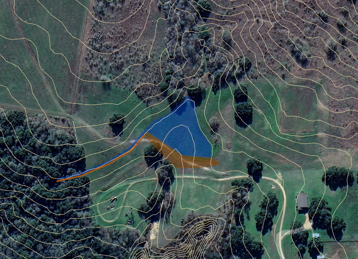
With these criteria in mind, we do an in-depth study of the landscape to determine whether or not the stated goals are obtainable, and the expectations are realistic. This involves measuring the catchment area to see how much water is moving through the site and determining if this quantity of water will be appropriate for the customers requested size of the water body. The dam should be sized appropriately with the available catchment area. We will study the topography of the customers property. With this information the best possible locations for the dam can be identified and also determines if more water can be brought into the pond with diversion berms. The Topography maps are digital and overlayed onto satellite imagery which helps customers to understand the scope and scale of the project more clearly. Soil data obtained from the NRCS website can provide detailed information about water holding capacity, soil depth, depth to bedrock, and potential problems that may arise while building the dam embankment. If it appears the site is suitable f0r dam construction, we will commence digging test holes to verify soil data in the field.
The topography map will be utilized to create a digital layout for the dam construction which will show the position of the dam, the spillway, the boundary of the high-water line, and any other related features of the dam. This will layout shown on satellite imagery will be reveal the shape of the water body and how it relates to the rest of the landscape. At this point the project will be ready for surveying in the field to verify all elevations. We usually use landscaping flags to transcribe the map concept onto the ground. This often requires some preliminary brush clearing or mowing of the site so that the markers can accurately be placed and remain visible.
Dam Construction
Before beginning the dam construction, the customer will receive an estimate for the cost of the pond. This estimate will include equipment costs, labor, fuel, and materials that are needed to fulfill the goals of the project. We include costs for revegetation of the site for example seed, seed application, and management of brush that has been cleared.
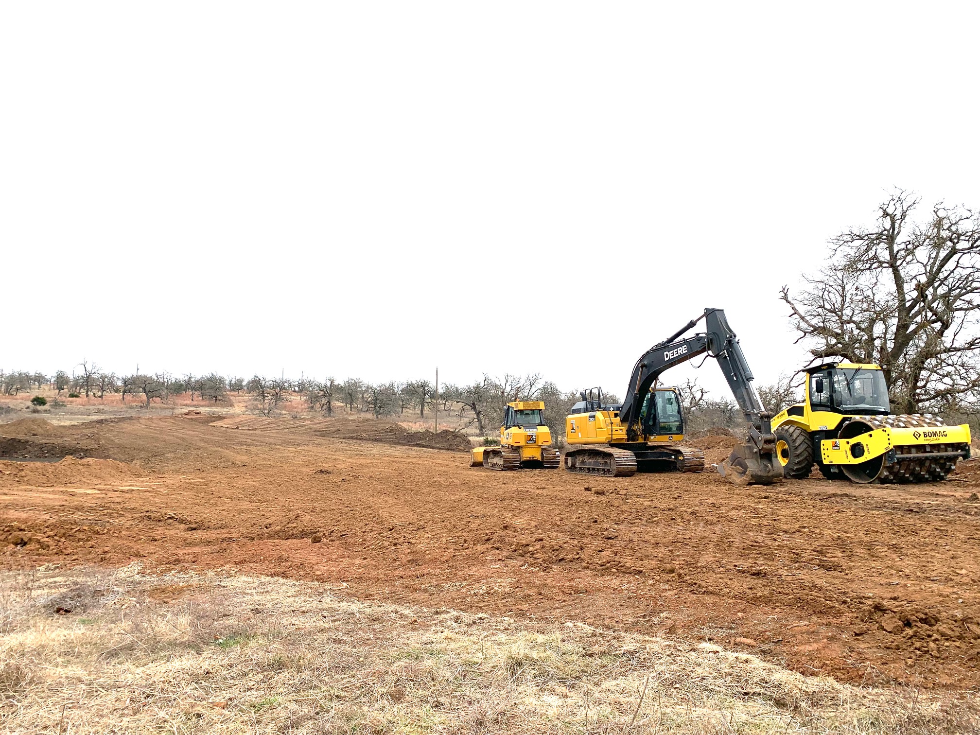
Once an agreement has been reached and approved, we monitor the weather and only begin work during favorable weather conditions. Ponds can be drained during construction if rain comes, but it’s best to avoid this if possible. If the weather looks good, equipment can be mobilized to begin moving dirt. All trees and stumps are then removed from the entire dam and pond site. The grass and 6-12 inches of topsoil is removed and stockpiled for later use. The dam should be free of organic matter and ideally all large stones are removed and used later for erosion control. Once the site is clear of topsoil dam construction can begin. Methods for this construction can vary depending on the site. But in general, the dam will be built in 6 to 12 inch “lifts” or layers of compacted dirt. Compaction can be achieved by using a pad foot roller or in some cases for larger dams a fully loaded scraper. To dig the pond a variety of equipment can be utilized depending on the context and conditions. Bull dozers, excavators, dump trucks, scrapers, loaders, etc. Materials are sorted by quality and used appropriately. When the dam crest reaches the plans final elevation, it is shaped smooth and prepared for the application of topsoil. Topsoil is applied on the dam structure primarily and secondarily around the edges of the pond at the high-water line.
Revegetation
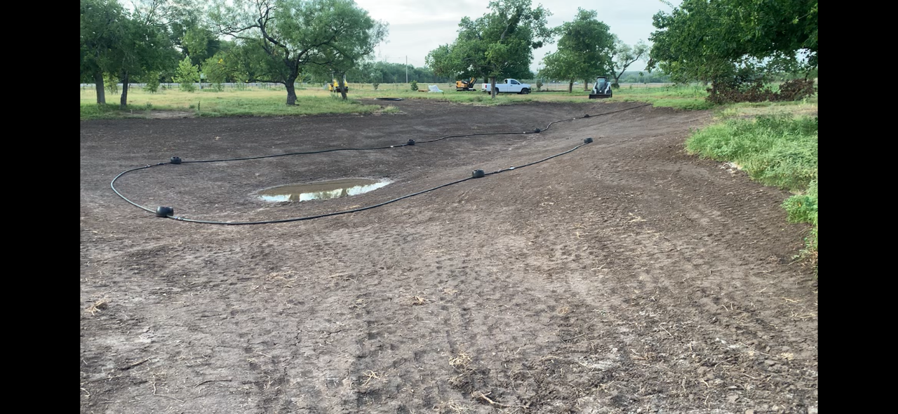
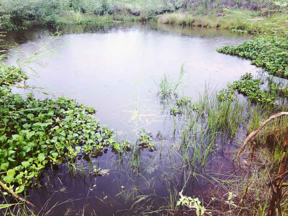
The final step for dam construction is revegetation and clean up. Seeds are then applied to the dam wall and gently track rolled into the soil. If budget allows, it can be helpful to apply a thin layer of mulch to protect the dam from erosion until plants begin to grow. Seeds should also be applied to the areas along the water’s edge if good grasses do not already exist. Van Dyck Earthworks strives to keep all equipment activity confined to the work area. The customer’s property should not be completely destroyed during the process of dam construction. We want to have clean and smooth lines with grass completely untouched along the edge of high-water line. The importance of this cannot be overstated but is often ignored! Preserving vegetation around the edges of the pond helps to ensure that the water is clean and clear instead of cloudy with sediment. Once the dam fills with water plants should recover the site quickly. We will provide guidance on any required maintenance activities so that the dam will provide generations of enjoyment.
Date
August 26, 2016
Category
Ranch and Farm Land